


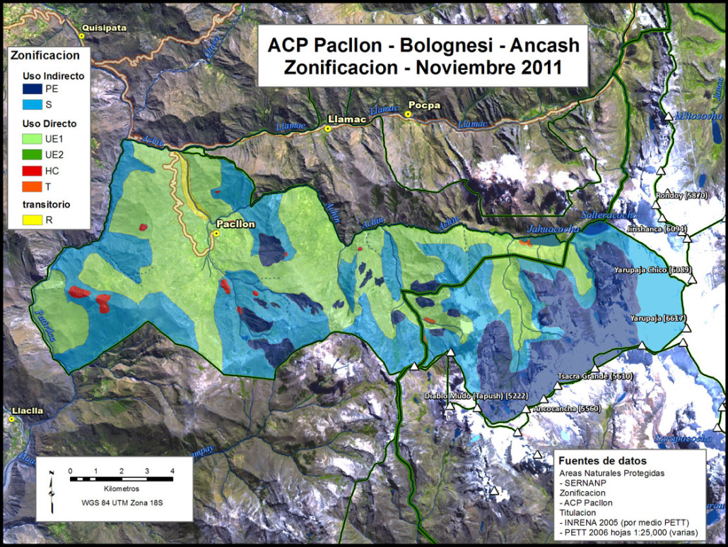
In the Cordillera Huayhuash conservation (both locally and nationally led), tourism, ranching and mining all exist in the same range of mountains. These diverse activities generate conflicting interests for the use, management and access to the natural resources in the region. In 2011, as an attempt to minimize conflict, a conservation zoning effort was initiated by a partnership between the local communities, a local non-government organization the Centro Desarrollo Huayhuash, and national protected areas service (SERNANP). The effort was both a success and a failure; see “Bridging the Great Divide: State, civil society, and ‘participatory’ conservation mapping in a resource extraction zone” for more information.
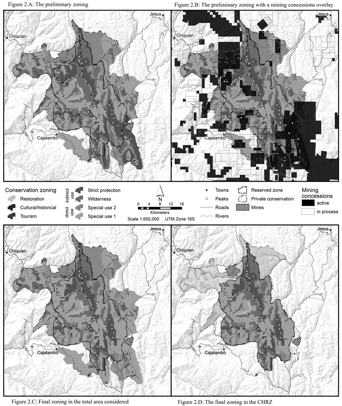
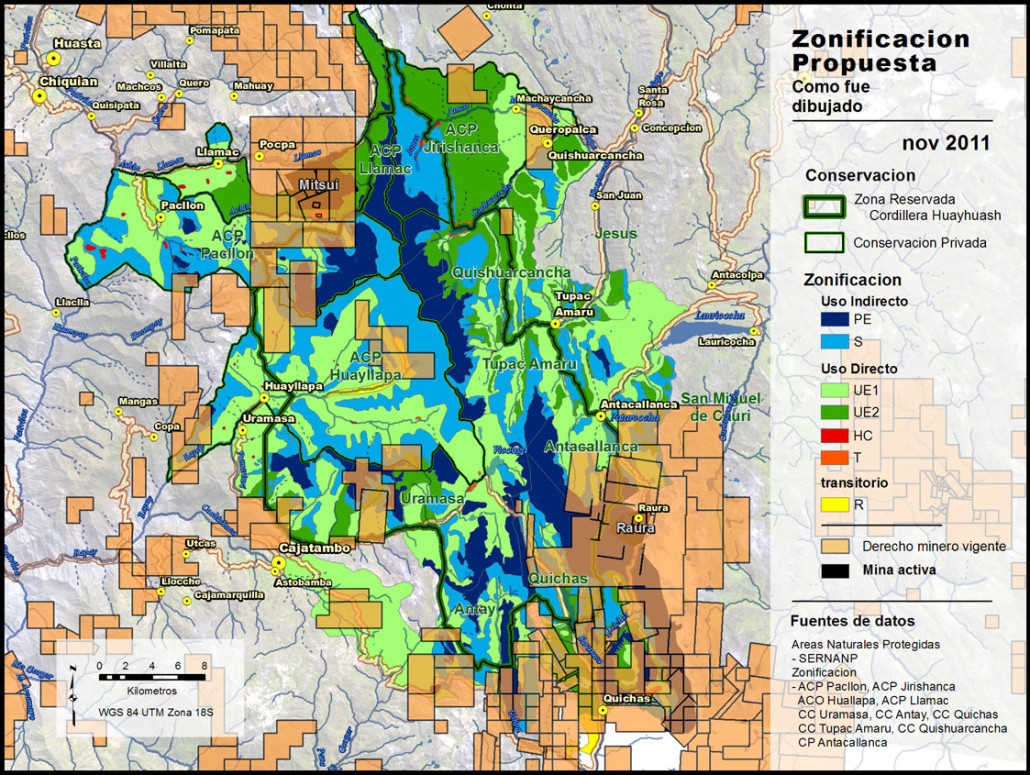
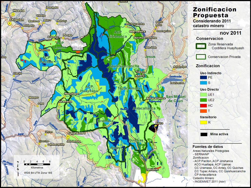
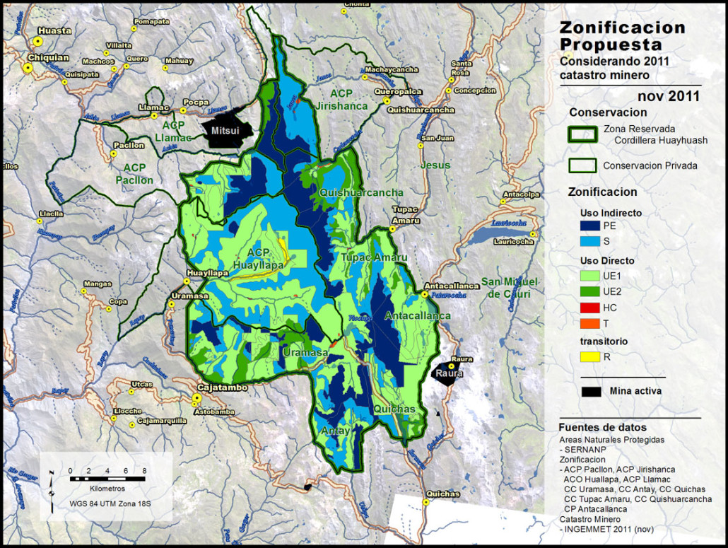
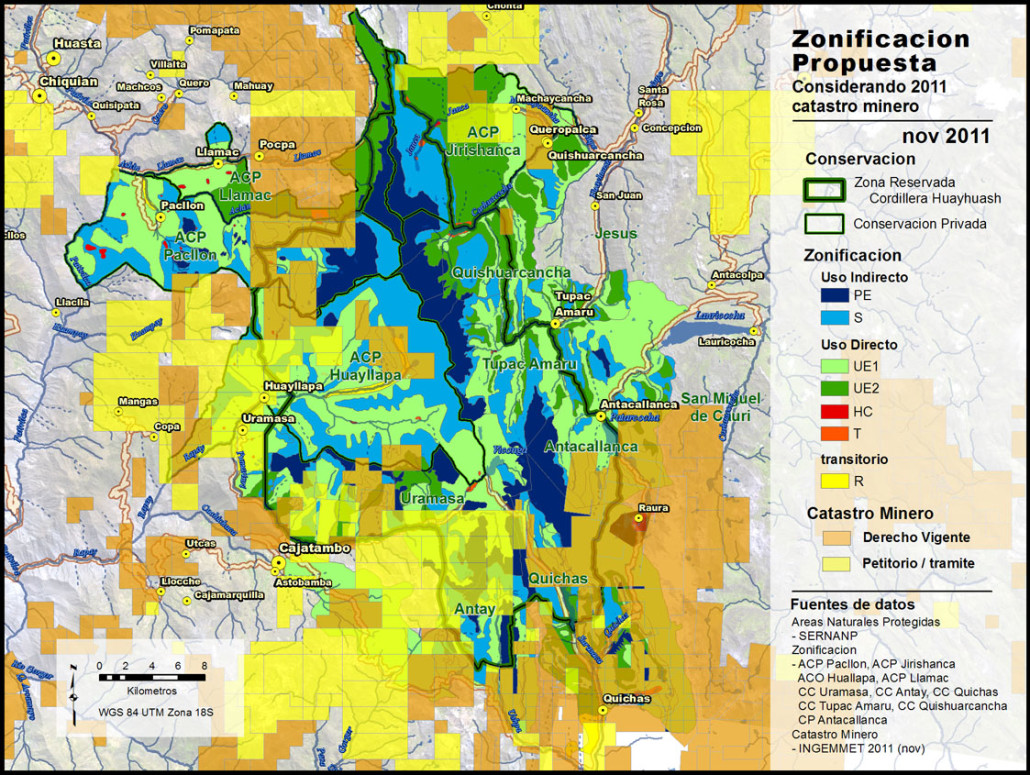
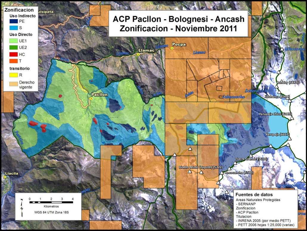
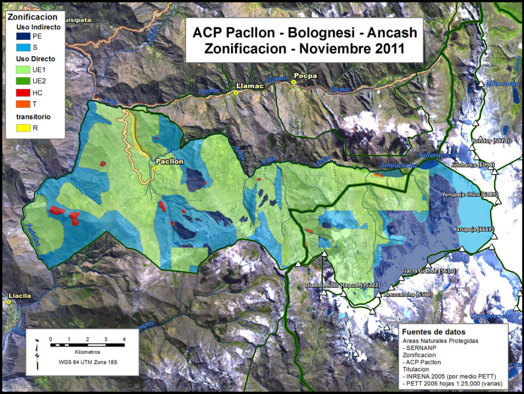
The above map was constructed in ArcMap and finished in Adobe Photoshop; the black and white design is for publication in a journal article. This zoning map is the culmination of an effort that involved over 100 individuals in many different organizations. An alternative map was designed for presentations (below) that shows the process starting with the digitized zoning maps from each of the ten communities, moves to an overlay analysis with the pre-existing mining rights, and then moves to the final stages where the community led conservation zoning and mining rights are combined into an adjusted zoning only within the state protected areas boundary.
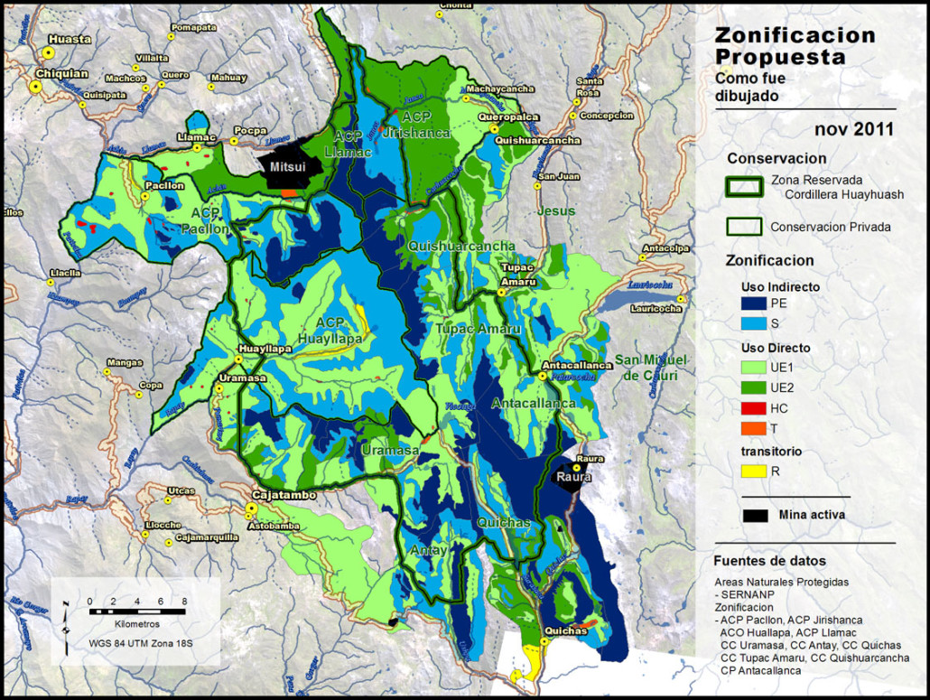 The zoning as drawn by the local communities
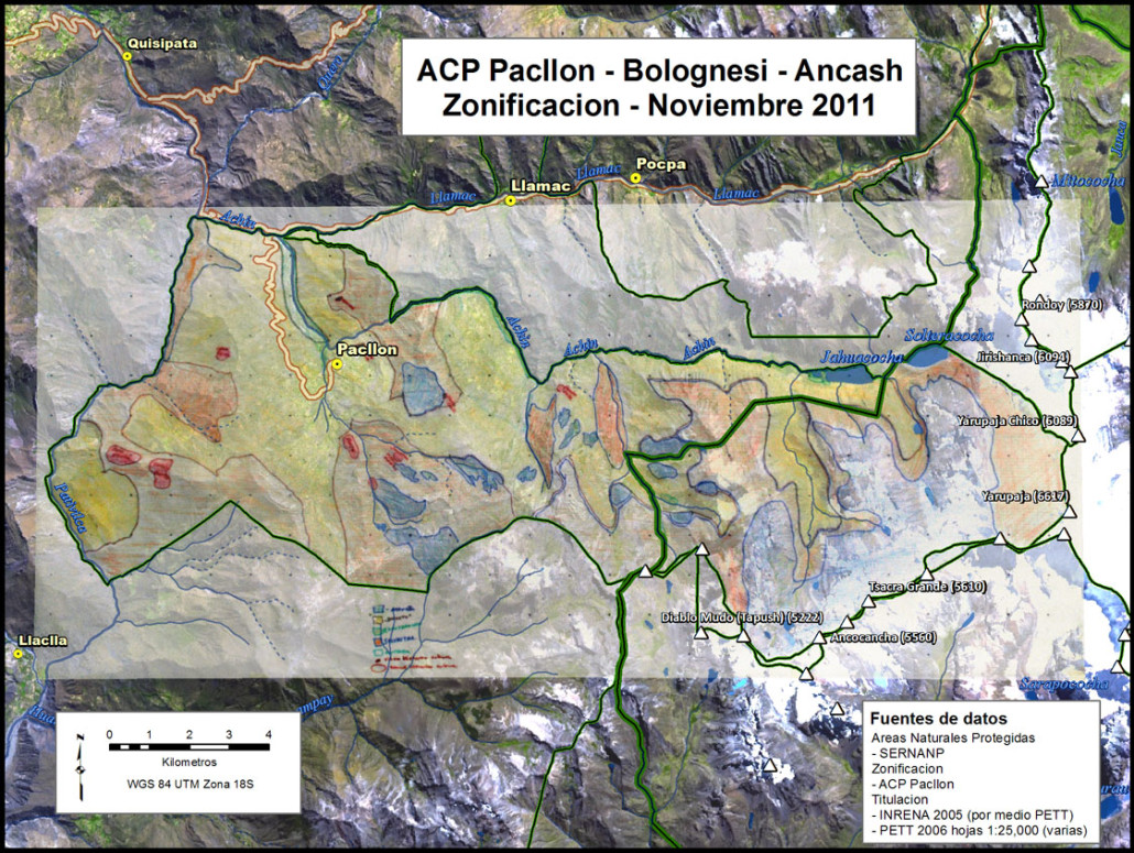
In the maps below you can see the same process as above, but at the community level. Prior to this effort Nawi Maps had already provided services at a community level for Llamac and Queropalca.
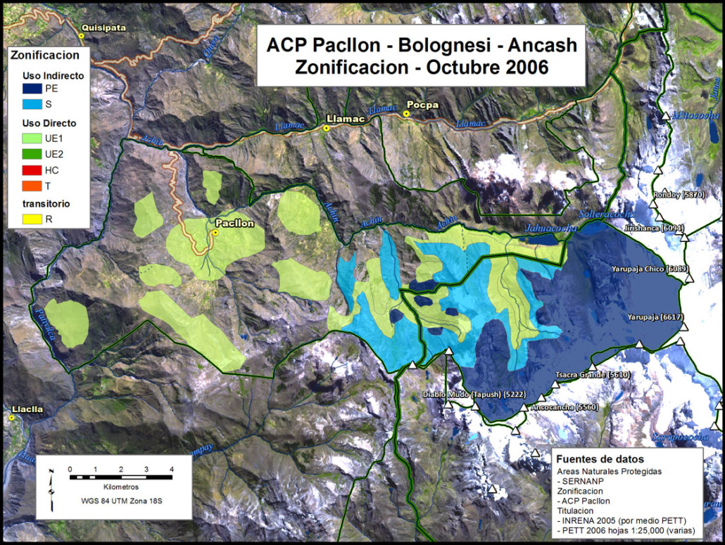 The original community conservation zoning
All of the service that Nawi Maps provided to this project was voluntary.
