


The Cordillera Huayhuash is a remote range of mountains located in the central Peruvian Andes. It is known amongst climbers and adventure seekers for its rugged terrain and vibrant local culture. This region has been well populated for many centuries due to productive high-alpine pastures for sheep and cattle (originally llamas) and rich mineral deposits of lead, zinc, and mercury. This map shows the territorial juxtaposition of national and local interests in conservation, both of which seek to limit mining, but only with limited collaboration.
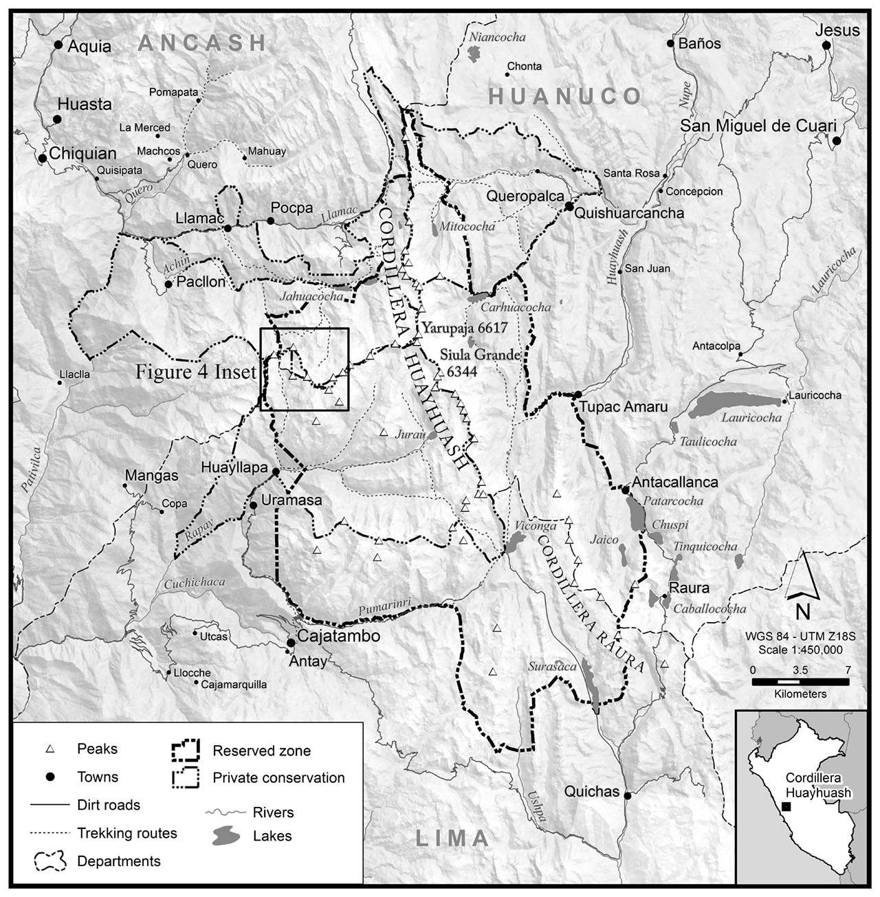
Although it may look simple, the shaded relief on this map uses several different techniques blended together. It starts with a DEM in ArcMap and uses the hillshade function. Then a TIN was generated and colored using an adapted Raven Maps topographic color scheme. Both of these layers were then blended with a satellite image and exported to Photoshop where they were blended once again with the grey-scale DEM.
The data for the line-work was sourced from several government agencies in Peru and then was combined with data collected in the field with GPS units.
The final map was produced in Photoshop.
This map was made for the article Bridging the Great Divide: State, civil society, and ‘participatory’ conservation mapping in a resource extraction zone in Applied Geography.
