


Llamac is a small town located in the heart of the Cordillera Huayhuash in the central Andes of Peru. In 2007 the community decided to create a private conservation area within most of its territory. Nawi Maps helped with the conservation zoning and the drafting of the master plan for the area. Both of these products were produced through participatory processes in which Nawi was a facilitator of production and an editor of the final products. The map below is one of many created in this process that was undertaken as a partnership between the community of Llamac, Nawi Maps and the National Protected Areas Service in Peru (SERNANP). The master plan was completed in 2009 and the private conservation area was formally recognized in 2010.
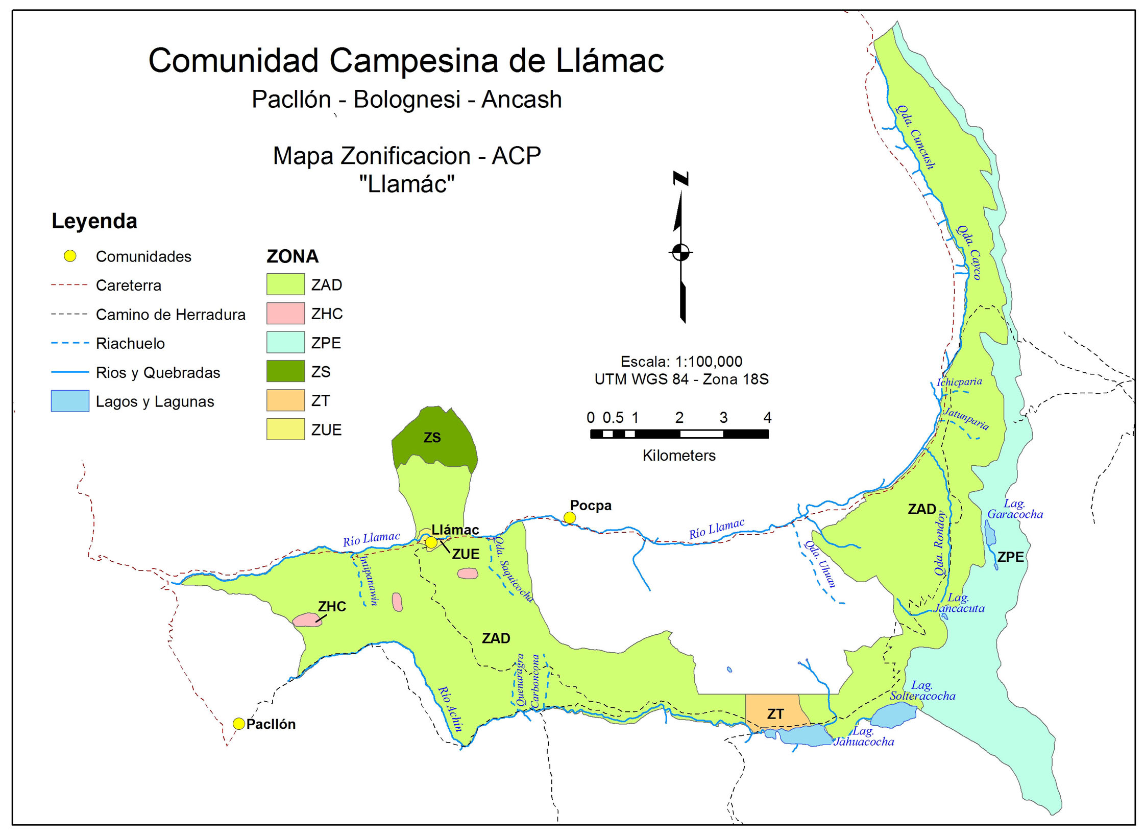
This map was built and finished in ArcMap. While the community paid a flat fee for this work (substantially less than other offers), over half of the money was either paid back to community members who performed the work, or spent on travel logistics for community members who were a part of the process (for example to go to the SERNANP offices in Lima).
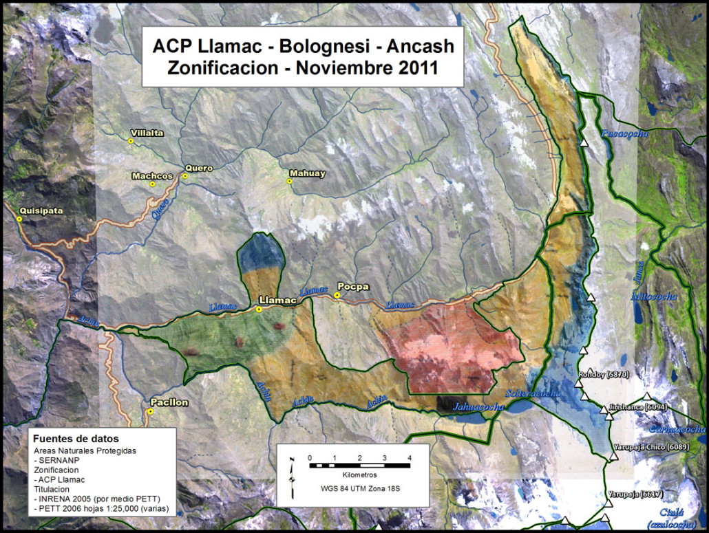
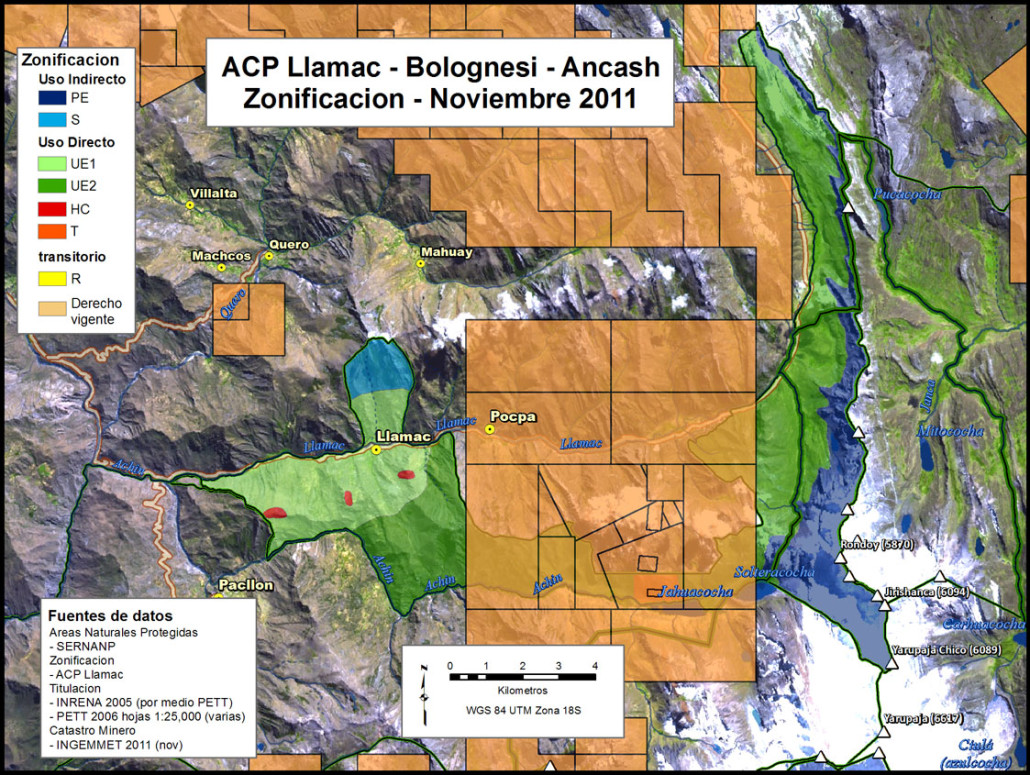
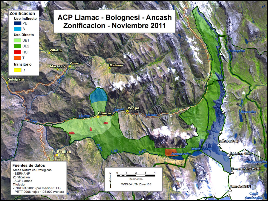
The series of maps below gives an idea of the participatory process. First the zoning map is hand drawn in the community. Then it is digitized and an overlay analysis is performed using the already existing mining rights in the area. The final map is constructed after the overlay is complete
 The 2011 hand drawn community conservation zoning
See also the experience in Queropalca and the larger conservation zoning effort undertaken in 2011.
