


The University of California Industry-University Cooperative Research Program was located at UC Berkeley, but was considered a UC “system-wide” initiative. Their work focused on strengthening relationships between the UC system and the private sector. This included outreach at specific UC campuses and within the legislative community in California. The maps below show research relationships between specific UC campuses and individual private sector firms. From 1996 to 2008 Nawi Maps provided services to maintain a geographical database of matching grant programs in several different high-tech sectors in California for this program.
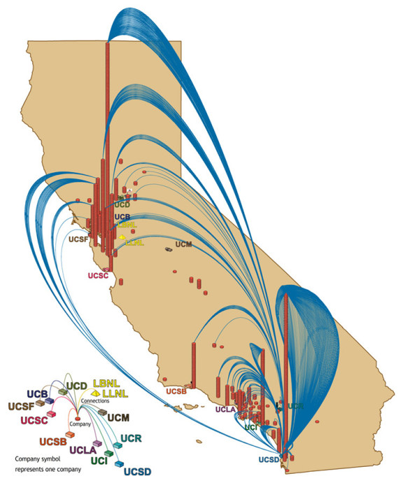
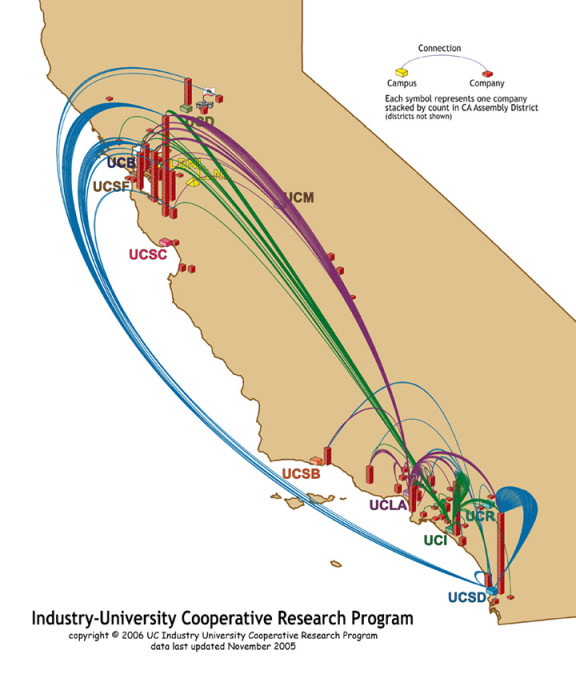
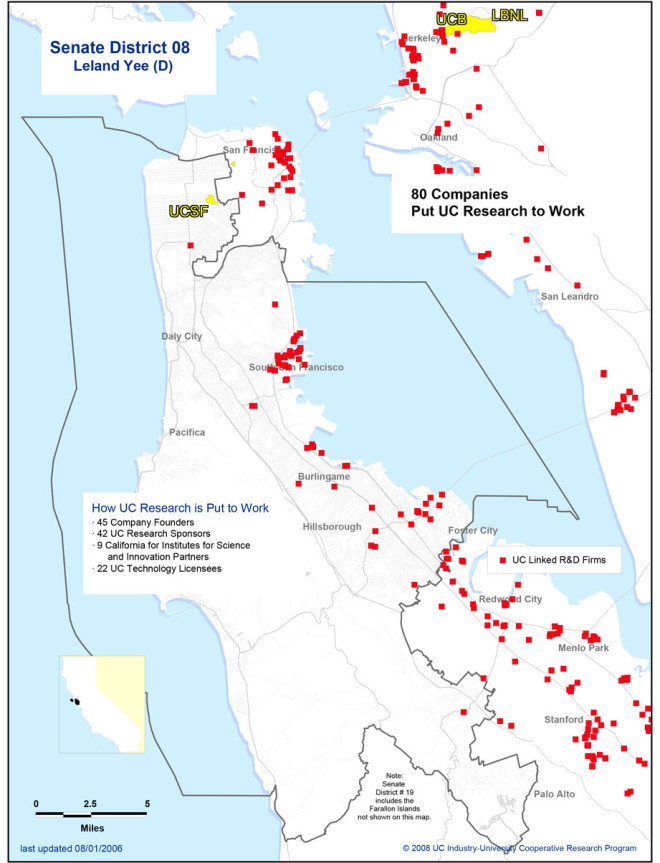
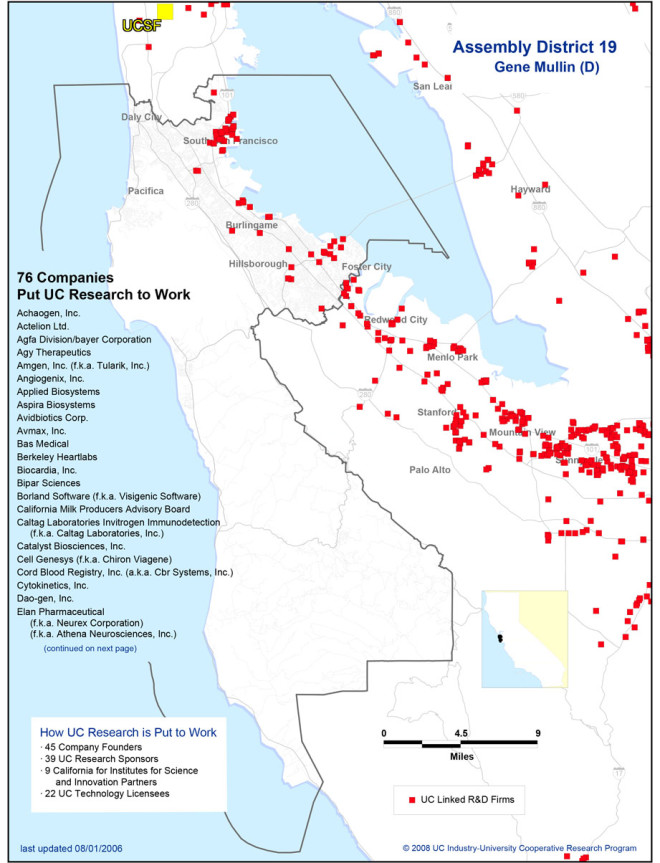
While the map above was used for lobbying specific campus administrators, the maps below show the same data aggregated regionally and by legislative district. The main GIS was built with MapInfo and MapBasic (now maintained by Pitney Bowes) and included a custom built system of what are now referred to as “data-driven pages.” For the most part the geographical scope was limited to California but there were hundreds of different maps created for the US and California legislative districts as well as campus-centric and regional maps.

Other work performed for the IUCRP included building a web-based mapping system that had both intranet and internet components. The web-based mapping system was originally constructed with MapInfo’s MapXTreme product and then in the early 2000’s was migrated to mysql and MapServer. All of the printed materials were built in MapInfo and then finished in either Macromedia Freehand or Adobe Photoshop.
In 2008 the UC-IUCRP was dissolved and Nawi Maps lost this contract in the administrative re-shuffling. The map project now lives here and is run by a colleague at the University of California Santa Cruz in the Center for Integrated Geospatial Research. The work remains very similar.
