


Between 1998 and 2000 the offices of public registry in the departments of Ancash and Lima (both in Peru) registered two different border delineations for two neighboring highland towns (there should only be one border). As a coincidental bedfellow to this registry error, a mine started their operations in the opened space that purportedly had no owner.
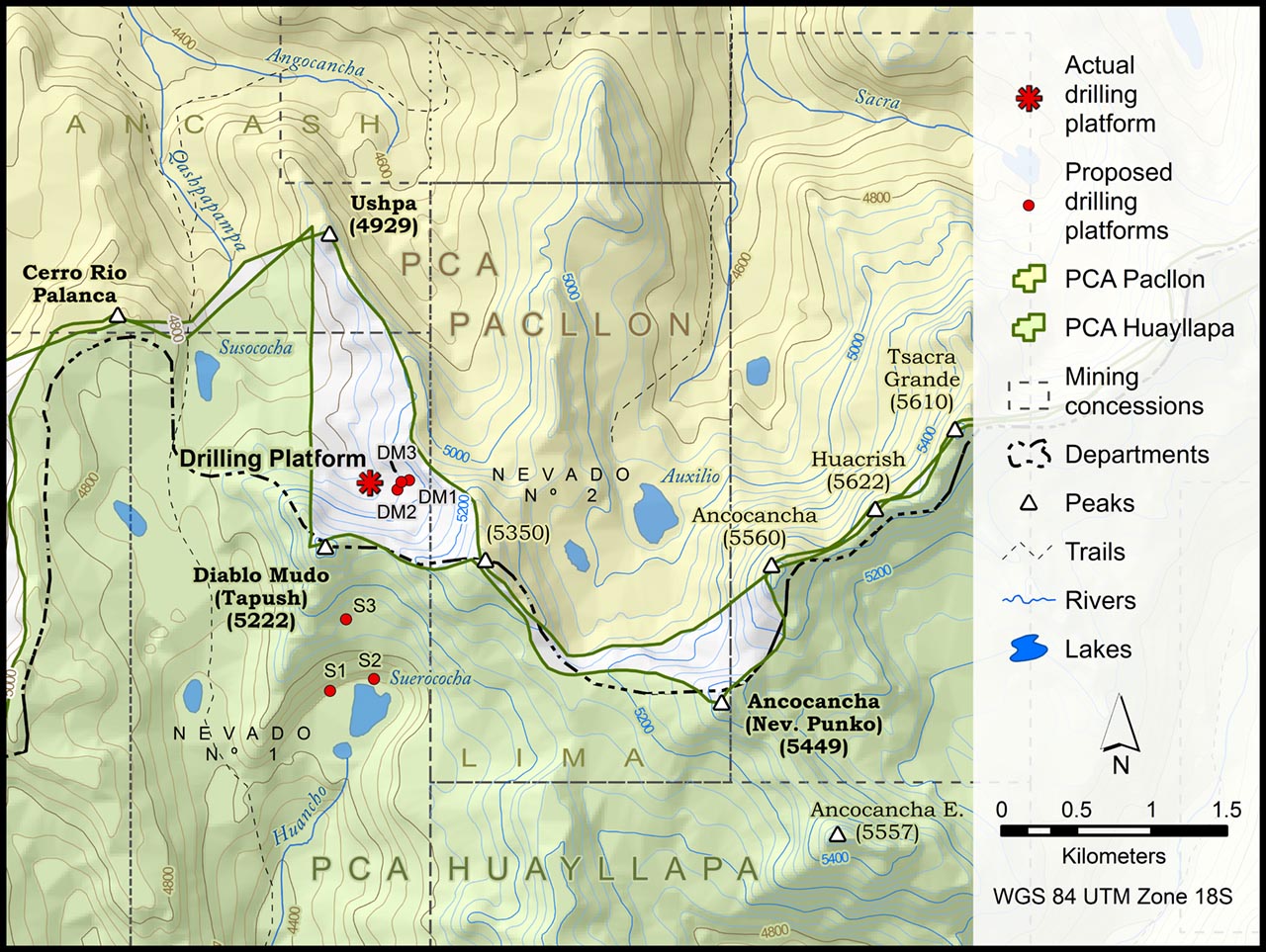
This map neatly showed the extent of the error and told a story plain and simple. In 2011 it was used in a power point presentation to call into light the territorial problem at a mesa de dialogo (negotiating table) between the mine and the communities. The mine eventually backed down. More details on this story can be found in this press release or this journal article.
The map was constructed entirely in ArcMap (one of the few).
