


The Centro Desarrollo Huayhuash (Huayhuash Development Center) is a small grassroots non-governmental organization based on the principals of social justice and conservation. Local priorities that include concerns about the social and environmental impacts of increasing presence of mines in the area, the booming trekking industry and the longer-term ranching activities, are the focus of their work. The interactive web page shown below is but one of the mapping activities for which Nawi Maps provides pro bono services.
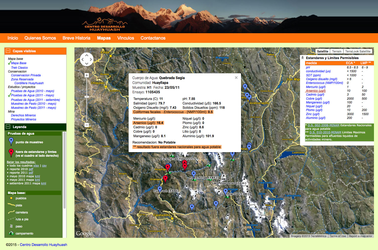
The page shown above is a web-map visualization for data collected over years of work with the NGO; some might even call it a mash-up. The map is constantly evolving and includes data that comes from the communities themselves (local toponym knowledge and also a water monitoring project and a pasture evaluation project), data collected over the years from various ministries in Peru, and data served directly from the ministry of energy and mines in Peru. The base map tiles are rendered with MapServer, the conservation, pasture and trekking layers are saved as KML, the water quality data is stored as GeoJSON and rendered through javascript by the client. The left-had accordion interface was re-invented for this page, but could easily be implemented with another out-of-the-box javascript library.
