


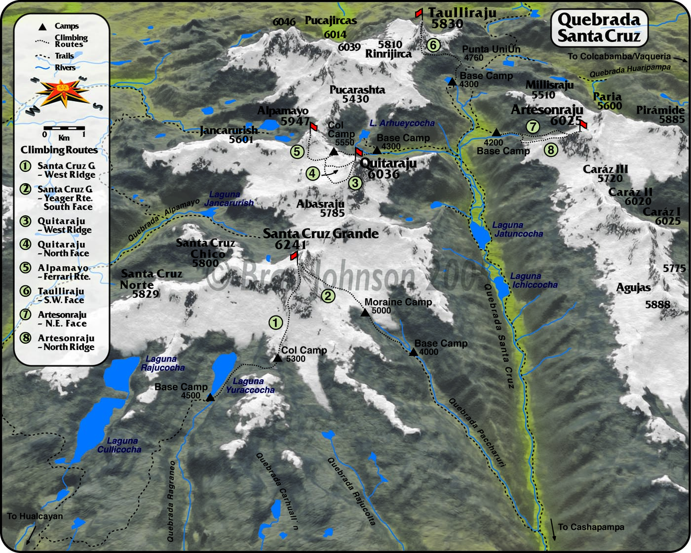
Brad Johnson of Peaks and Places approached Nawi Maps in 2001 with a proposal to prepare all of the maps for his guide book Classic Climbs of the Cordillera Blanca. He wanted three-dimensional maps of the Cordillera Blanca, one for each massif, upon which he could draw climbing routes. In 2001, with the existing data in Peru and technology at hand, this task required a lot of creativity and hard work. The book was published in 2003 and then again in 2010.
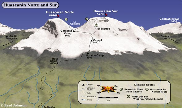
These maps were started as a set of vector contours in ArcMap. The original data was part of a government dataset of 1:100,000 topographic quadrangles maintained by the Instituto de Geografia Nacional. The contours were converted to a TIN which was then heavily edited to correct the many errors in the government contours. Once the TIN was completed, it was converted to a DEM and exported. The DEM was brough into KPT Bryce (an old Mac 3D raytracing program), given texture and color (artificial, but based on altitude, steepness, and aspect), and then rendered. The final maps were built in Freehand, exported as EPS files for use in the book layout realized in Quark.
At the time it all seemed very cutting edge, but now it can only be called old-school.
