


The first map made by Nawi Mapas in Peru was for the book Die Sechstausander der Cordillera Blanca by Gerhard Feichtenschlager. This book is a coffee table style photo book of all of the peaks of the Cordillera Blanca over six-thousand meters. The map is a simple locator map to give geographic reference to the collection of photos.
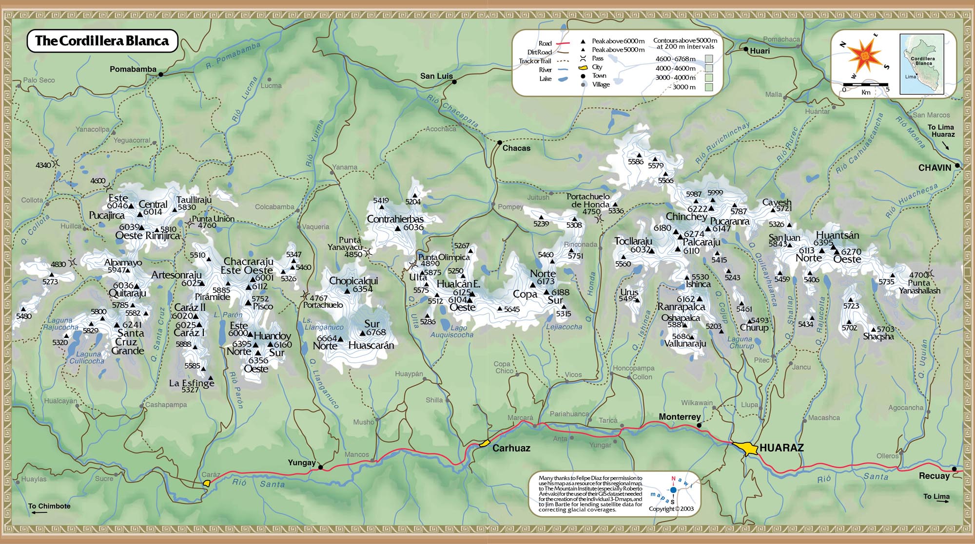
This map was made in Macromedia Freehand with very sparse data. The shaded relief was constructed in KPT Bryce from a DEM created in photoshop from 200 meter contour data acquired from a local map-maker. Everything else is hand drawn in Freehand.
