


This maps was the final project that Tim Norris prepared for a cartography class at UC Berkeley (1995). While the cartographic technique used for the map was very experimental at the time (see below), the content of the map was judged insufficient (or perhaps even in bad taste). The professor awarded the effort a C (what!).
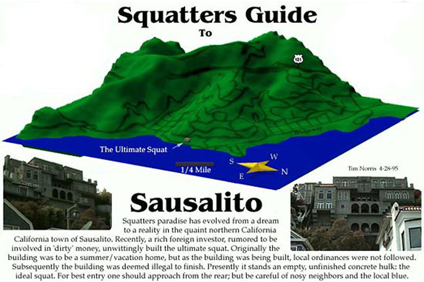
This is one of the first maps constructed using the KPT Bryce ray-tracing software on a Macintosh. A DEM quadrangle was imported into Bryce and used to render the elevation. The streets were traced in Freehand from the same quadrangle and then exported as a JPG for import into Bryce. Aligning the DEM with the streets in Bryce was a major challenge and the results were far from perfect. The North arrow and scale bar were constructed from 3D primitives in Bryce. Once the render was complete, the image was brought back into Freehand and the final text and layout was completed.
Several future contracts, including the maps for Classic Climbs and Machu Picchu, used a similar technique.
